MAPPING pH IN NORTHERN REGION OF GHANA
This is a geostatistical predictive modelling of soil pH in the northern region of Ghana.
- Completed: January 2021
- Context: IFDC-Fertilizer Research and Responsible Implementation
- Tools: R Programming
SEMIVARIOGRAM MODEL
The semivariogram is a necessary step in geostatistical prediction. It is a statistical model of the spatial structure of the observed quantities being modelled, in this case, soil pH. The range, sill and nugget are key informational statistics derived from the semivariogram. The plot shows that the range of spatial autocorrelation for soil pH in the northern region is about 25km.

MODEL EXPLAINED VARIANCE
The set of explanatory variables could explain about 40% of the variability in the maize yield.

pH PREDICTION USING ORDINARY KRIGING
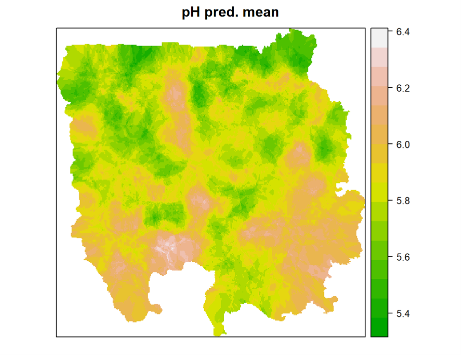
Ordinary Kriging is a geostatistical model that assumes that there is a constant unknown mean across the study area. The map indicates that the soils have a nearly neutral pH (5.4-6.4) which is good for maize production.

pH PREDICTION STANDARD DEVIATION
In addition to the predictions, Ordinary Kriging produces a variance for each prediction based on which the standard deviation was calculated. As shown in the plot, the standard deviations for the predictions are much less than 1SD which indicates a reliable prediction accuracy.
